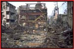
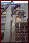
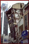
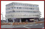
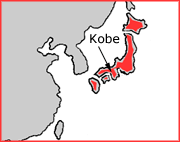
Kobe, 17th January 1995
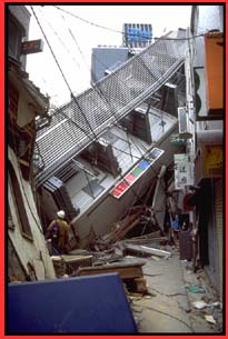
At 5:46 in the morning, a magnitude 6.9 (Mw)
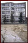
earthquake struck Kobe in Japan. About 5,500 people died and
35,000 were injured. Nearly 180,000 buildings were badly damaged
or destroyed, leaving more than 300,000 people homeless that
night.
The earthquake was caused by movement on a
fault running from Awaji Island through Kobe. (See
Map)
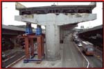
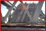
It lasted for only 20 seconds, but in that
short time, very severe damage occurred. The resulting economic
losses were believed to have been the greatest caused in modern
times by any natural disaster.
|